
Google Earth: ระบุที่ตั้งของพยาน
ค้นหาว่าภาพถูกถ่ายที่ใดและอัพโหลดเมื่อใด
ทำความรู้จัก Google Earth
ในการตรวจภาพถ่ายหรือวิดีโออย่างสมบูรณ์แบบ คุณต้องยืนยันว่าภาพนั้นถูกบันทึกที่ไหน เมื่อไหร่ และใครคือผู้ถ่าย
โลกเสมือนจริงแบบโต้ตอบ Google Earth ช่วยคุณทำขั้นตอนแรกของการระบุตำแหน่งให้เสร็จสมบูรณ์ได้อย่างรวดเร็ว
ภาพสำคัญที่เกิดขึ้นในสังคมออนไลน์มักจะประกอบด้วยเบาะแส เช่นอาคาร หรือสถานที่สำคัญ ที่จะช่วยคุณระบุตำแหน่งที่ตั้ง อย่างไรก็ตาม ภาพที่ถ่ายในระยะไกล หรือพื้นที่ชนบทมีความท้าทายมากขึ้น
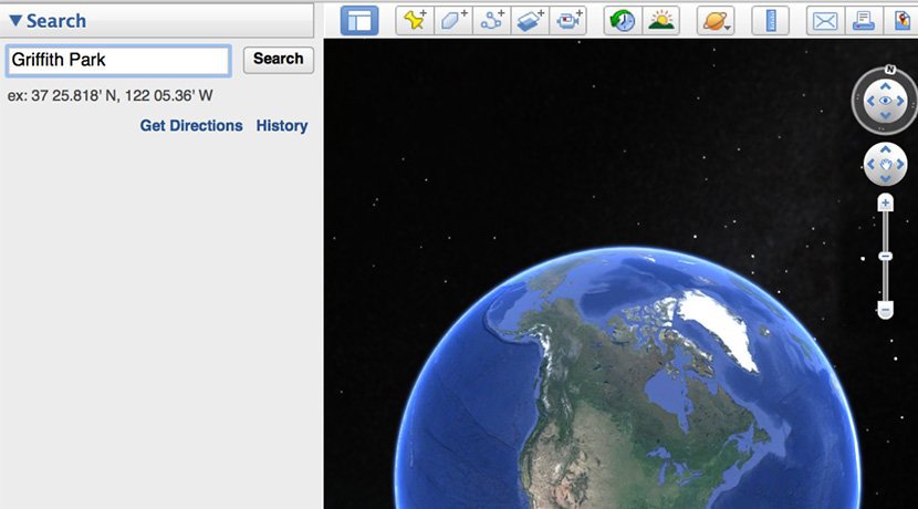
ในการเริ่มต้นของกระบวนการตรวจสอบ ดาวน์โหลด Google Earth รุ่นล่าสุด:
เตรียมเปิดใช้งาน
หลังจากที่คุณติดตั้ง Google Earth สิ่งแรกที่คุณต้องทำคือ "เดินทาง" ไปยังภูมิภาคทีคิดว่าสื่อที่คุณตั้งคำถามมาจากที่ใด พิมพ์ชื่อประเทศ เมืองใหญ่ เมืองย่อย หรือแม้แต่สถานที่สำคัญใน Google Earth จากนั้นดาวเทียมจะแสดงภาพไปยังตำแหน่งที่ตั้งนั้น ยิ่งคุณสามารถระบุตำแหน่งได้ชัดเจนเท่าใด คุณก็จะยิ่งได้ข้อมูลที่ดีกว่า
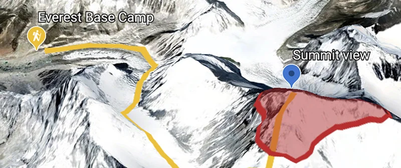
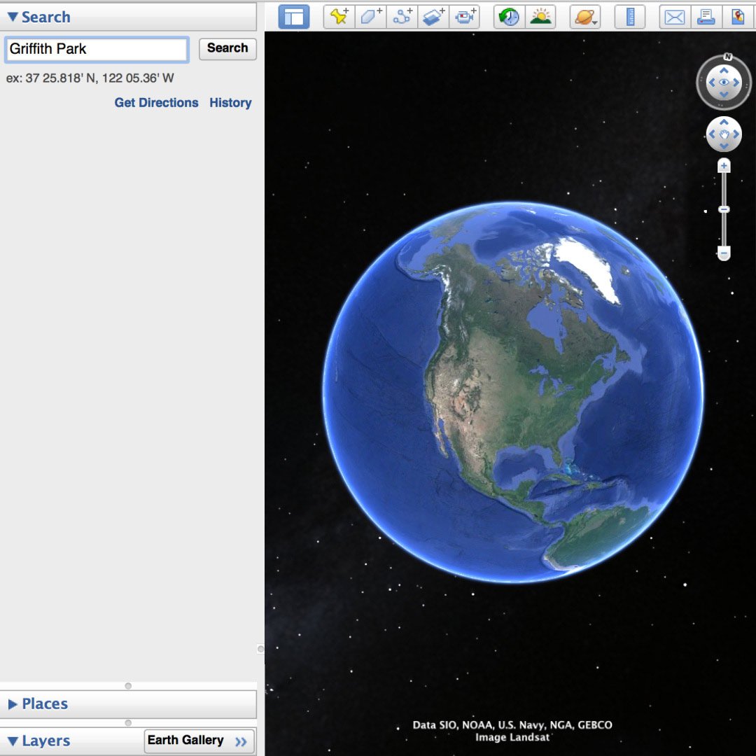
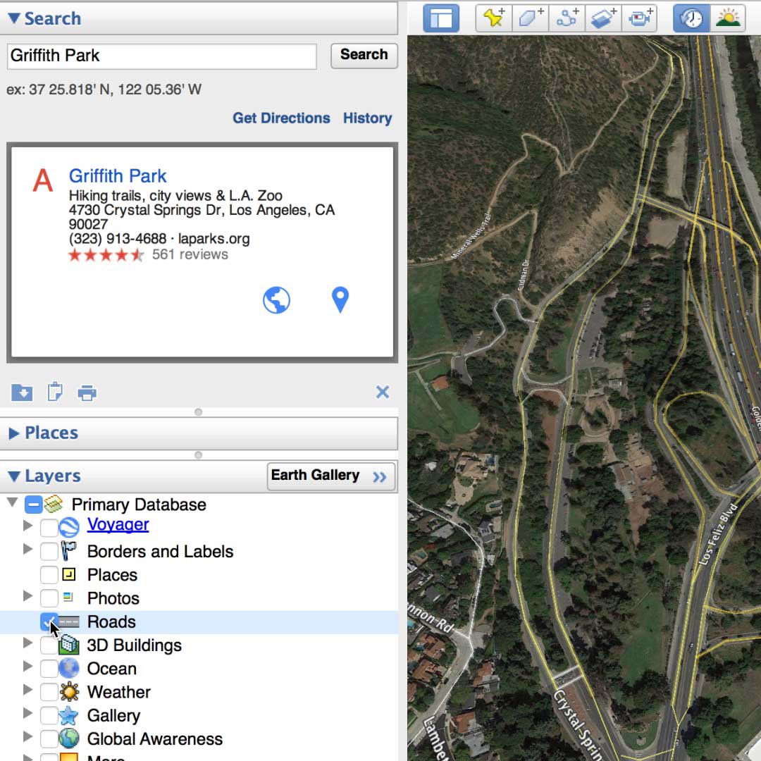
สมมติว่า คุณกำลังค้นหาเกี่ยวกับไฟป่าที่แคลิฟอร์เนียทางตอนใต้ และพบภาพบนทวิตเตอร์ที่อ้างว่าถ่ายจากลอสแองเจลิสใกล้กับ Griffith Park
พิมพ์ Griffith Park ในกล่องค้นหาของ Google Earth เพื่อเป็นการเริ่มต้น
Google Earth จะซูมเข้าไปเพื่อเริ่มค้นหาเบาะแส
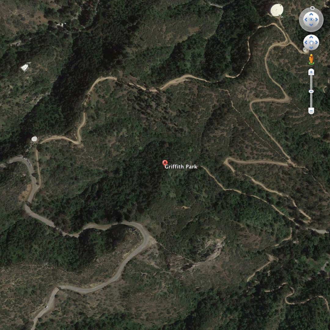
การหาเบาะแสที่เป็นภาพ
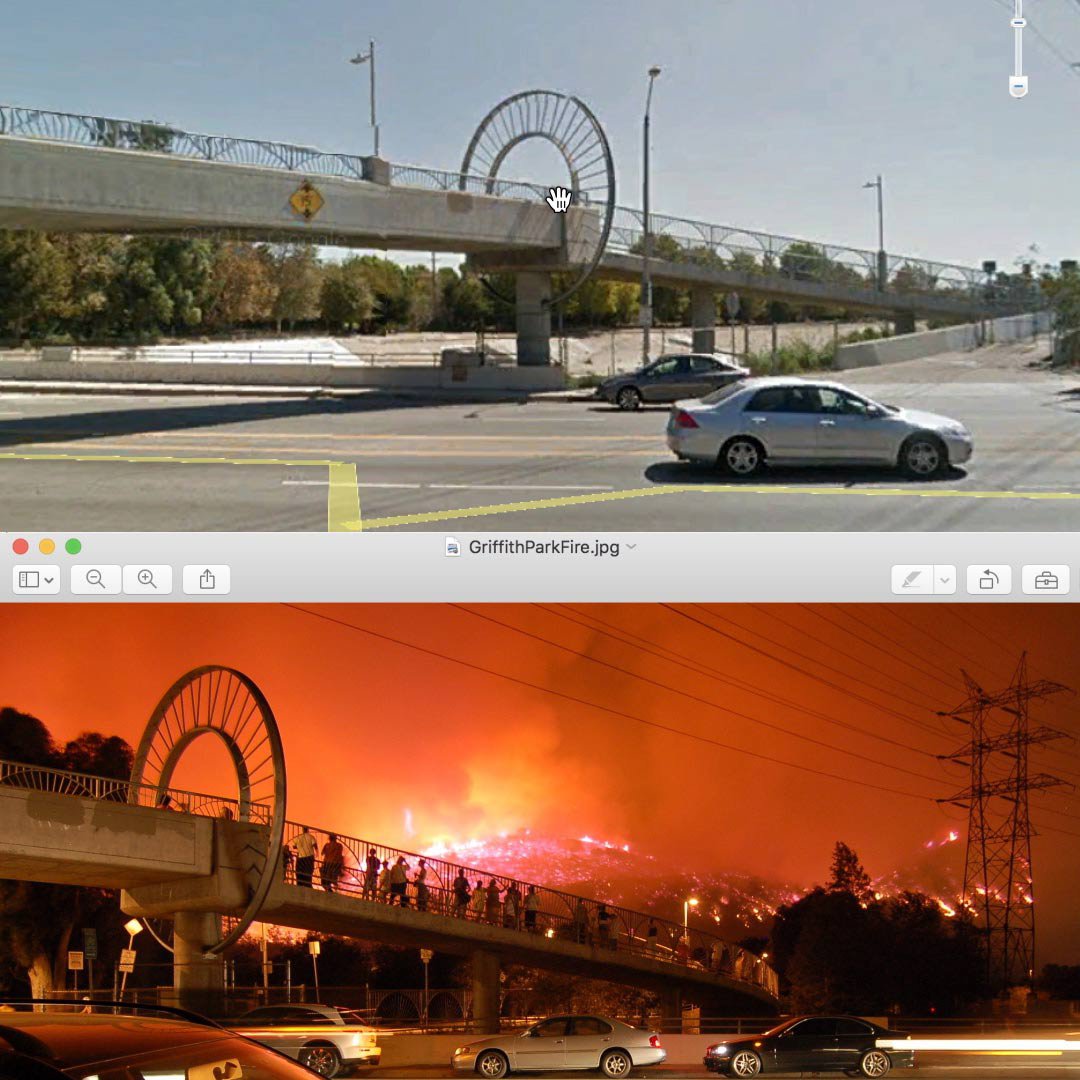
เมื่อมี Google Earth ทำงาน ถึงเวลาที่จะกลับไปยังรูปภาพหรือวิดีโอของคุณ และศึกษาอย่างรอบคอบสำหรับภาพที่มีเบาะแสที่จะช่วยให้ขอบเขตการค้นหาของคุณแคบลง
สถานที่สำคัญ ป้าย อาคารที่โดดเด่น ถนน การเปลี่ยนแปลงความสูงอย่างฉับพลัน คุณภาพน้ำ พื้นทเปิดกว้าง พื้นที่สีเขียว...ทำรายการองค์ประกอบทั้งหมดที่คุณเห็นในภูมิภาคของคุณ อีกทั้งยังสามารถพิมพ์ภาพนิ่ง หรือใช้ภาพหน้าจอเพื่อเปรียบเทียบภาพบน Google Earth
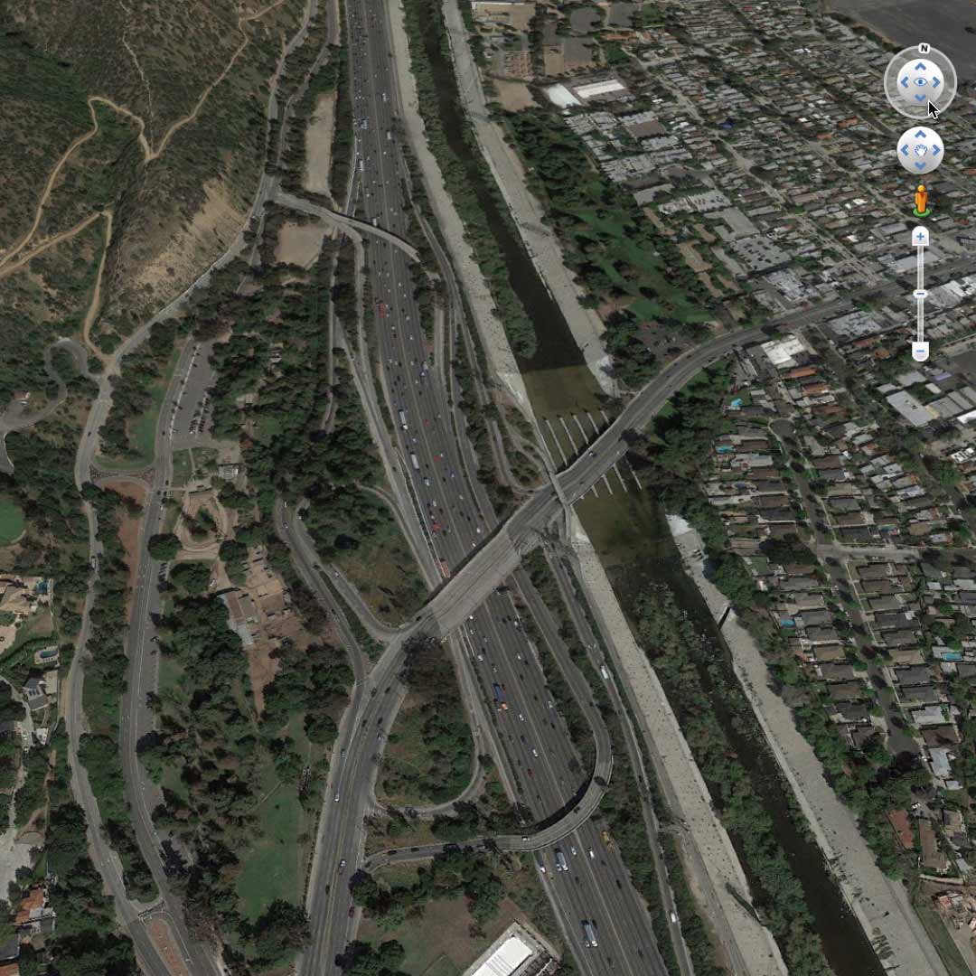
ในกรณีนี้ เรากำลังมองหา Griffith Park ที่ขนานกับแม่น้ำลอสแอนเจลิส นอกจากนี้เรากำลังมองหาสะพานลอยที่ข้ามถนนสำคัญ
ใช้แถบเลื่อนเพื่อขยายจนกว่าจะมองเห็นคุณลักษณะภูมิประเทศ จากนั้นคลิก และลากเพื่อสำรวจพื้นที่โดยรอบ
ใช้ชั้นเพื่อแก้ไขมุมมองของคุณ
เรื่องของ ชั้น แผงบน Google Earth ช่วยให้คุณสามารถเลือกชนิดของข้อมูลที่คุณต้องการในตัวแสดงสามมิติได้ การคุณลักษณะที่แตกต่างอาจระบุเบาะแสตำแหน่งที่ตั้งเพิ่มเติมได้
การเลือกและยกเลิกการเลือกกล่องกาเครื่องหมายที่อยู่ถัดจากชั้นเฉพาะ โดยการเปิดและปิด ตัวอย่างเช่น การเปิดชั้น ถนน จะแสดงถนนหลวงด้วยเส้นสีเหลืองและถนนรองด้วยเส้นสีขาว พร้อมชื่อถนน ปิดใช้งาน และข้อมูลนี้จะมองไม่เห็น
ระบุตำแหน่งของคุณ
เมื่อคุณอยู่ในบริเวณใกล้เคียงที่ถูกต้อง คุณสามารถขยายเพื่อลองและจับคู่กับภาพข่าวของคุณบน Google Earth
ดับเบิลคลิกบนจุดที่จะขยายเข้าสำหรับมุมมองใกล้ ใช้ลูกศรนำทางด้านบนขวาเพื่อเอียงและเปลี่ยนมุมมองของคุณ
หากคุณขยายเข้ามากเกินไป คลิก ออกจากมุมมองระดับพื้นดิน ที่มุมขวาบนของหน้าจอเพื่อทำให้ภาพที่กว้างขึ้น
เมื่อคุณพบตรงตำแหน่งที่ถูกต้องแล้ว คุณสามารถหาวิธีการในการตรวจสอบเพิ่มเติมได้ เช่น วันที่หรือผู้เขียน ถ้ามีความเกี่ยวข้องกัน
ตรวจสอบข้อมูลรูปภาพ
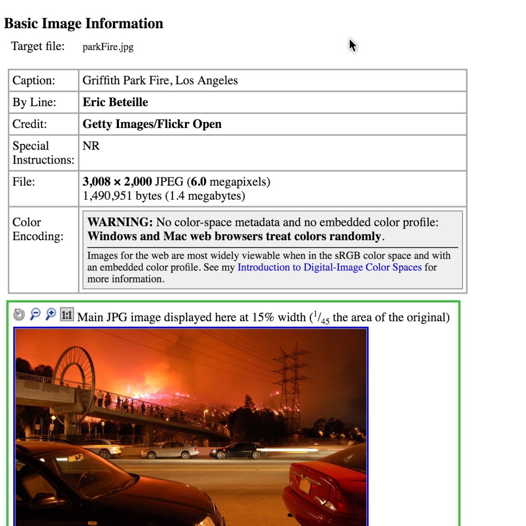
ภาพดิจิตอลทั้งหมดประกอบด้วยข้อมูล EXIF: ข้อมูลถูกรวบรวมโดยอุปกรณ์ที่จุดจับภาพ เช่น เวลา วันที่ พิกัดละติจูด และพิกัดลองจิจูด ป้อนพิกัดเหล่านี้ใน Google Earth เพื่อนำคุณตรงไปยังสถานที่ที่ถ่ายภาพ
อย่างไรก็ตาม เครือข่ายสังคมออนไลน์ส่วนมากและแอปส่งข้อความตัดข้อมูล EXIF ออก ดังนั้นควรถามถึงแหล่งที่มาจะได้อีเมลภาพต้นฉบับเพื่อให้คุณสามารถดึงข้อมูล EXIF ได้ด้วยตัวคุณเอง มีเครื่องมือมากมายที่คุณสามารถใช้สำหรับงานนี้ได้ รวมถึงสิ่งนี้: http://regex.info/exif.cgi
เรียนรู้เพิ่มเติมเกี่ยวกับการใช้ Google Earth สำหรับการตรวจสอบ ดูกรณีศึกษาจาก First Draft
ดูคู่มือฉบับเต็มของ Google Earth คลิกที่นี่
-
![5.4_9oVu9sc.jpg]()
เครื่องจักรมีการเรียนรู้อย่างไร
บทเรียนรายละเอียดเบื้องต้นแบบเป็นขั้นตอนเกี่ยวกับกระบวนการฝึกสอน ML -
![YouTube Thumbnails (17)]()
-
![GoogleEarthCreationTools_TellYourStoryAcrossTheWorld]()
เครื่องมือในการสร้าง Google Earth: บอกเล่าเรื่องราวของคุณไปทั่วโลก
บทเรียนวิธีการใช้ Google Earth เพื่อสร้างเรื่องราวที่น่าสนใจ