


Global Fishing Watch:漁船と船舶を監視する

Global Fishing Watchのマッピングツールを使用して、地球規模における漁獲活動を追跡するためのガイド。
レッスンの概要
Global Fishing Watchの概要紹介
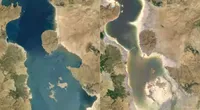
Global Fishing Watchは、Oceana、Skytruth、Googleの協力によって世界で初めての商業的漁業に関する公開アクセス型のビューを提供することを目的として誕生しました。それ以来、独立非営利組織として別組織を設立し漁業における透明性の向上を通して、持続可能な管理を目指す取り組みを続けてきました。
- Global Fishing Watchに参加する
- Global Fishing Watchのマップを探索する
- Global Fishing Watchツールボックス
- Global Fishing Watchで検索
- AISとVMSのデータについて
For more Environmental Journalism lessons, visit:
newsinitiative.withgoogle.com/training/course/environmental-journalism
Global Fishing Watchに参加する
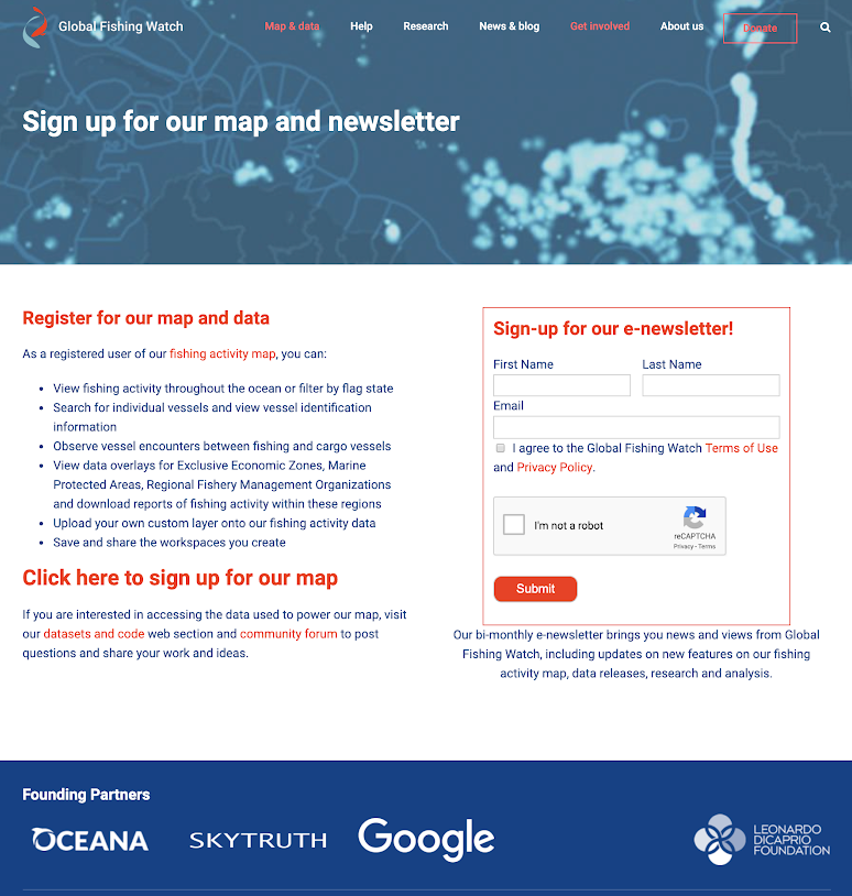
船舶の追跡やカスタムの船団を作成するといった、Global Fishing Watchのより高度な機能にアクセスするには、まずツールへのアクセスのためにサインアップする必要があります。
globalfishingwatch.org/joinにアクセスして、Global Fishing Watchアカウントに登録します。Gmailアカウントをご利用いただくか、ご自分のメールアドレスでアカウントとパスワードを作成できます。
Global Fishing Watchのマップを探索する
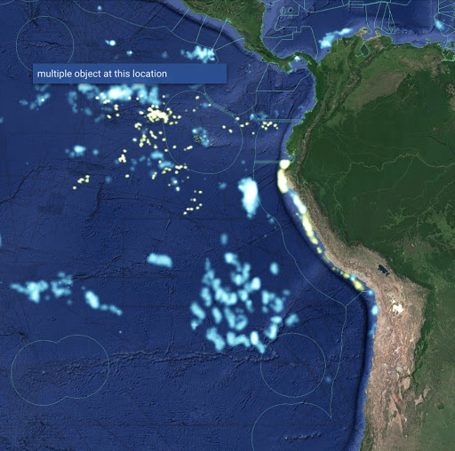
対話型マップによって世界中の漁獲活動をリアルタイムで追跡することができます。このマップは、さまざまな海洋システムから位置情報を取り込み地球規模の視点から商業的漁業の実態を示すことによってこれを行います。
ご登録いただくと、世界中の商業的漁業をリアルタイムで追跡するGlobal Fishing Watchのマップにアクセスしていただけます。
標準機能はマップの左側に表示されています。これらの機能によって、拡大/縮小、リンクとして共有または埋め込み、マップ上の距離測定が行えます。
マップ下部のタイムスライダーによって、漁獲活動を表示する期間が決まります。• 最も古い2012年1月1日から一番最近のリアルタイムまで表示されるカレンダーから、開始日と終了日を選択します。• 別の方法 - タイムスライダーの左端または右端のバーをクリックして、長押ししながら開始日または終了日までドラッグします。• 別の方法 - タイムスライダー内の強調表示された時間枠の左上隅にある歯車アイコンをクリックして、対象となる時間枠を調整します。
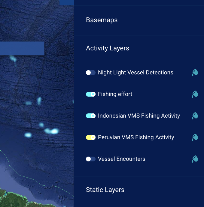
右上のツールボックスは、マップに表示されるデータのコントロールセンターです。
マップに表示されている漁獲活動から特定の船舶を選択するには:• 「fishing effort」をクリックしてツールボックスの船舶IDを開き、その船舶を追跡します。• 近接して複数の船舶が存在する場合は、拡大することが必要な場合があります。
Global Fishing Watchツールボックス
Global Fishing Watchのツールボックスによって、世界中の漁船のすべてから収集したデータと対話することができます。これにより個別の船、国を追跡したり、トロール漁船のカスタム船団を作成したりできます。
右上の「Vessels」タブをクリックすると、検索タブが開き任意の船舶を検索できます。
レイヤーをクリックすることにより提供されるオプション:基本マップを変更する。これは地図の外観に関係します活動のレイヤーを変更すると表示される情報の種類も変わります。最終的には、排他的経済水域または海洋保護区域などの静的レイヤーも編集でき、重ねて表示したり、白地図を編集したりできます。
マップに表示されている漁獲活動から特定の船舶を選択するには:• 「fishing effort」をクリックしてツールボックスの船舶IDを開き、その船舶を追跡します。• これには、近接して複数の船舶が存在する場所を
拡大する必要があります。Global FIshing Watchで「漁獲活動」とは何を意味しますか。このサイトでは船舶のID、種類、場所、速度と方向に関するデータを分析し、漁獲活動検出アルゴリズムを適用して、船舶の速度と方向に基づく「明確な漁獲活動」を判別します。このアルゴリズムは、これらの船舶の各予測データ地点について、明らかに漁業を行っているまたは漁業を行っていないとして分類し、前者を公開マッピングプラットフォームに表示します。
Global Fishing Watchで検索
特定の船舶を見つけてGlobal Fishing Watchのマップにカスタムの船団を作成することに関する入門。
ご自分のGlobal Fishing Watchアカウントにログインします。
ツールボックスの「Vessels」タブをクリックして、検索バーに船舶のID情報(船舶名、MMSI番号、IMO番号、コールサイン)を入力します。船舶の検索を実行している活動レイヤーがアクティブであることを確認します。そうでない場合は、何も結果が表示されません。
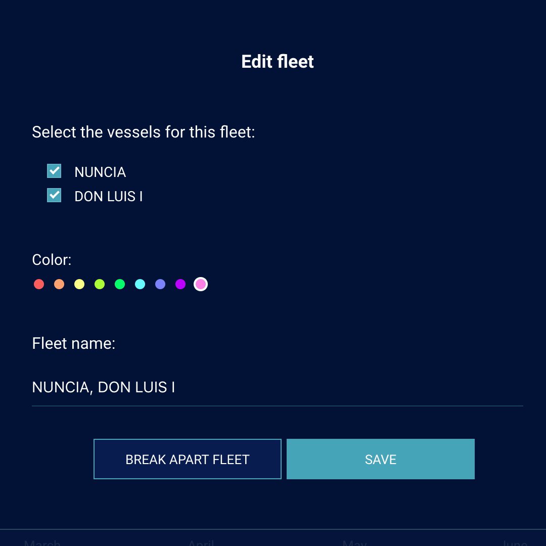
カスタム船団機能によって、船団としてマップを移動する(同一色で表されます)ように表示することを目的としてピン留めした、一連の船舶を選択してグループ化することができます。まず、船団としてグループ化する対象となる船舶を検索、または選択します。すべての船舶をピン留めします。すべてのピン留めした船舶が
「船舶」タブの下に表示されます。• 「Create Fleet」ボタンをクリックします• 船団に含める全船舶のチェックボックスを選択します。• 船団の名前と色をカスタマイズします。
作成した船団を削除する場合は、
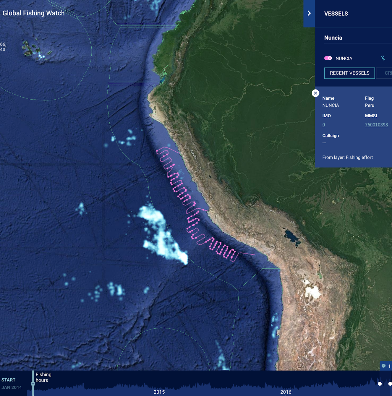
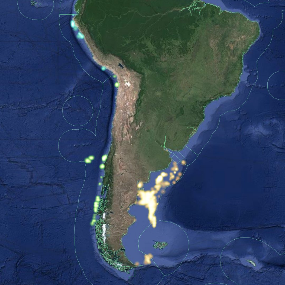
「fleet edit」ボタンをクリックして、次に「Break Apart Fleet」をクリックします。事例を交えて確認しましょう:「Nuncia」を検索する
船舶を選択します。同じ名前の複数の船舶が存在するため、正しい情報を見つけるには追加のID情報が必要な場合があります。この場合は、「MMSI 760010398」を探しています。
コンパスのアイコンをクリックすると、船舶の航路と一致するようにマップのビューポートとタイムスライダーが調整されます。船舶の航路を変更するには、ペンキ缶のアイコン(船舶がピン留めされると表示されます)をクリックします。この船舶を保存するには、ピンアイコンをクリックします。一度に複数の船舶をピン留めできることに留意してください。
下部のタイムラインで「play」をクリックして、南アメリカ沿岸を上下に動くNunciaの漁船の動きを表示します。
AISとVMSのデータを使用して漁獲活動を理解する
サブ:Global Fishing WatchのマップにおけるAISとVMSのアクティビティの概要AISとVMS。AISは大型の国際漁業船舶を監視するシステムであるのに対して、VMSは国内水域で漁獲活動を行う、より小規模な船に焦点を合わせています。
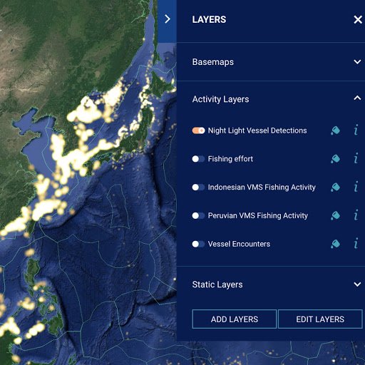
AISのデータを表示するには:ツールボックスの「Layers」で、「Activity Layers」を開いて船舶活動のオプションを表示し、マップに示します。漁獲活動はAISのデータを参照します。
レイヤーを有効にするには、レイヤーの左にある「toggle」をクリックします。「toggle」はレイヤーが有効にされると色付きで表示されるようになります。
マップでレイヤーの色を変更するには、ペンキ缶をクリックし、レイヤーの詳細情報を取得するには「i」アイコンをクリックします。
VMSのデータを検索するには:VMSのデータは「活動レイヤー」からも取得でき、国別に一覧表示されています。VMSの共有に関する性質は、各国のデータの周期性が異なることを表しています。詳細を確認するには、「i」アイコンをクリックします。
船舶の識別子に関連するVMSのデータが一部編集されていることをご覧いただけます。このデータはフラグのステータスが許可済みの場合にのみ公開リリースできます。
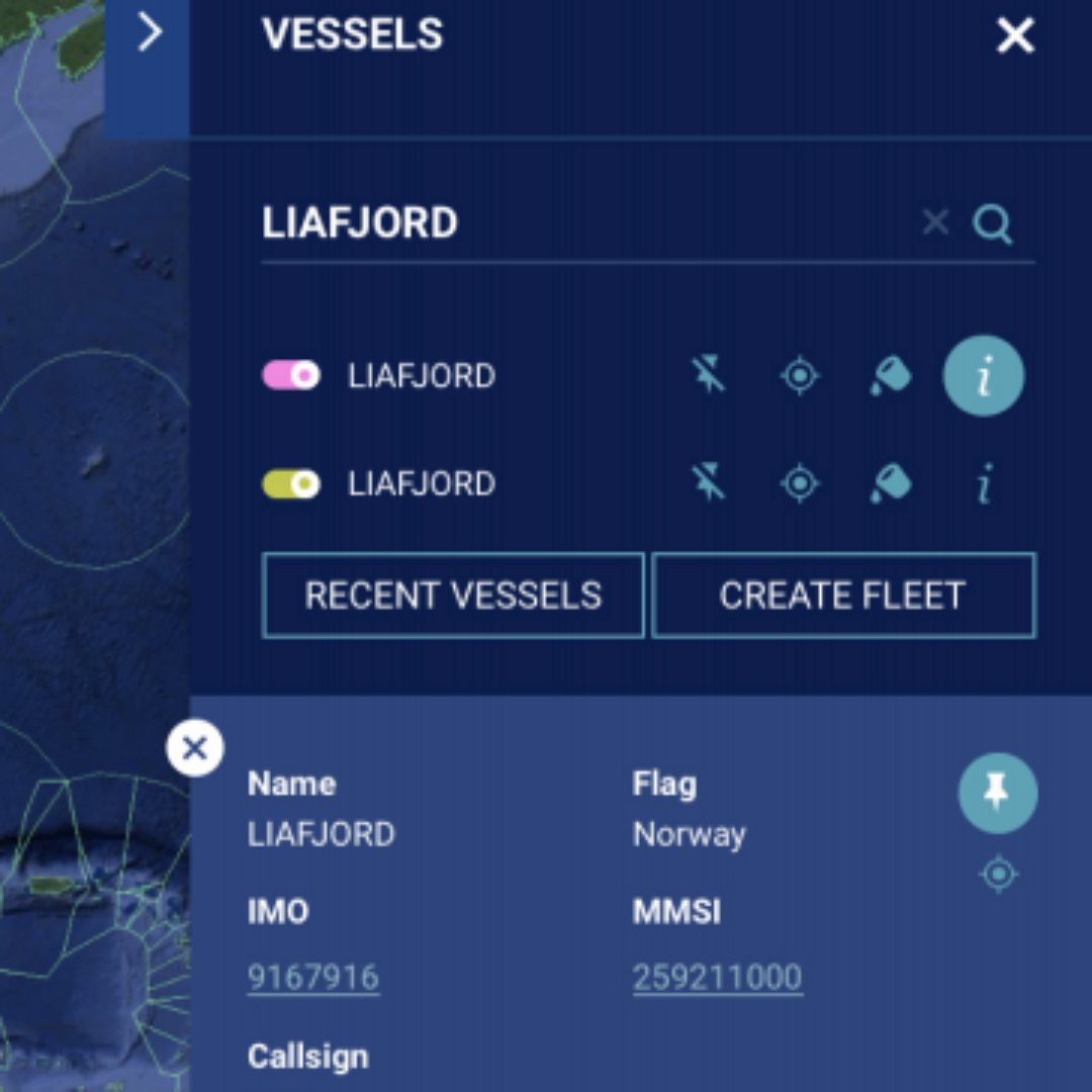
AISデータとVMSデータによる個別の船舶の航跡は、両方のレイヤーで船舶をピン留めすることで比較できます。「Fishing effort」をオンにして、他のすべての活動レイヤーをオフにします。(船舶の検索によって選択した活動レイヤーからのみ結果を得られます)
「Vessels」タブを開き、検索してLiafjordをピン留めします。
「Layers」タブを再度開き、「Peruvian VMS Fishing Activity」をオンにして、他のすべての活動レイヤーをオフにします。
「Vessels」タブを再度開き、検索してLiafjordをピン留めします。
「Activity Layers」を開き、Peruvian VMSデータを無効にします。これによって船舶の航跡をより明確に表示できます
「Vessels」タブでコンパスアイコンをクリックして、Liafjordの活動が中央に表示されるようにマップを表示します。
タイムスライダーで再生をクリックして、船舶の航跡とAIS/VMSデータを再生します。 レイヤーレコードの不一致をご覧いただけます。
VIIRSデータについて
サブ:マップでVIIRS、Visible Infrared Imaging Radiometer Suite、データについて解釈する方法をご説明します。
VIIRSの衛星用センサーは夜間の明るい光を識別できます。暗い海域では、明るい光を使用している船舶はこのセンサーによって検出されやすく、追跡することができます。イカ釣り漁業など、一部の形態の漁獲活動では夜間に明るい照明を使用します。そのためイカ釣り漁船はVIIRSデータで容易に確認できます。
漁船の中には、AISなどの船舶の追跡システムを使用する必要のないものも存在します。ただし、照明を使用して漁獲活動を行っている場合はVIIRSで検出できます。これらを見つけるには、「Layers」、次に「Activity Layers」の順にクリックします。
「Night Light Vessel Detections」と「Fishing effort」を無効にします。 開始日に2017年1月1日を選択します。
グローバルレベルまで縮小表示して再生をクリックし、これら2つのデータベースで検出された漁獲活動の違いを表示します。
今度は開始日に2018年1月1日を選択します。 ガラパゴス諸島を拡大表示します。船舶群はVIIRSのデータベースでのみ検出され、AISでは検出されない点にご注意ください。
これらの検出を行うことについてご理解いただくには、少し補足説明が必要です。まず一つ目は、実際にすべての船舶が漁船ではないことです。一部はその他の大型船舶の可能性があります。さらに、多くの船舶が照明を使用せずに、または非常に暗い照明を用いて漁獲活動を行っており、このデータセットに取り込まれません。最後に誤検出の問題があります。アルゴリズムによって光が検出された場所があっても、エラーまたはノイズが原因という場合があります。まれにではありますが、アルゴリズムが国際線の航空機を検出するという場合もあります。
レポートをダウンロードする
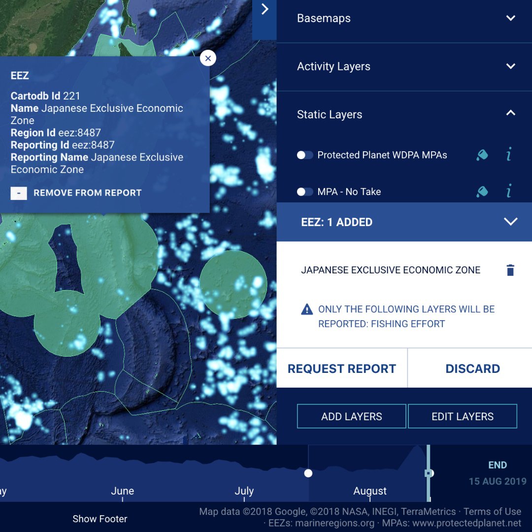
漁獲活動に関するダウンロード可能なレポートを作成する方法をご説明します。
まず、漁獲活動に関するレポートを作成するため、Global Fishing Watchのアカウントにログインしている必要があります。
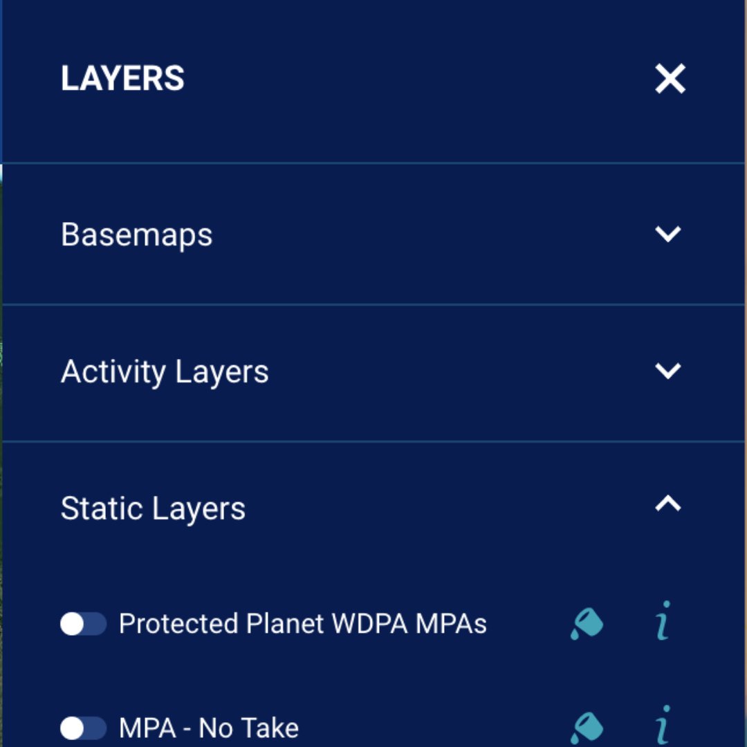
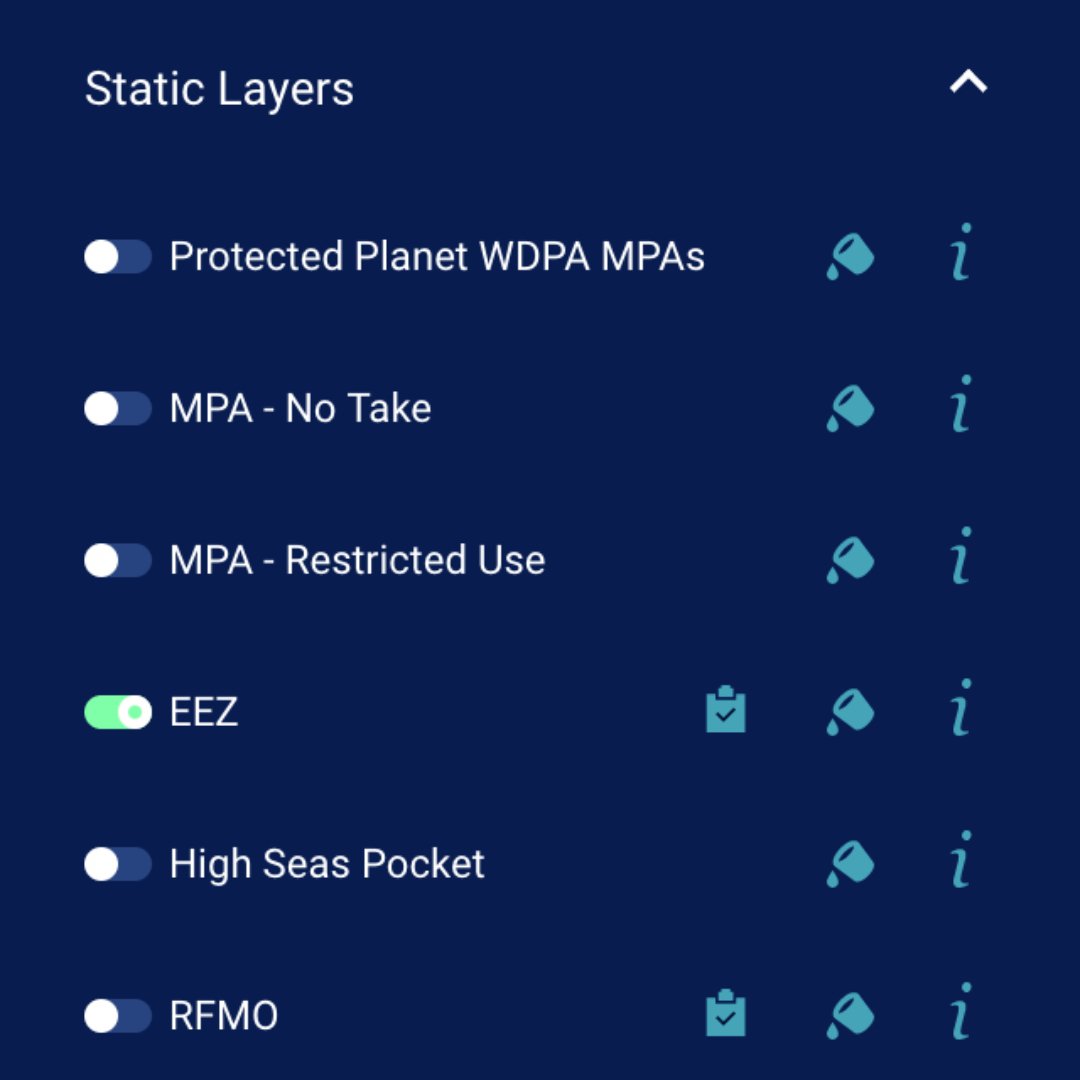
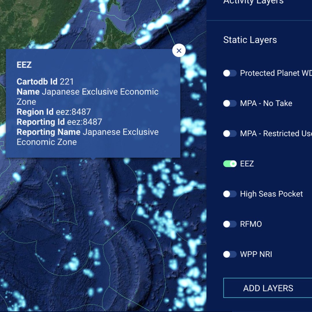
マップのツールボックスで、「Layers」タブ、次に「Static Layers」の順に開きます。
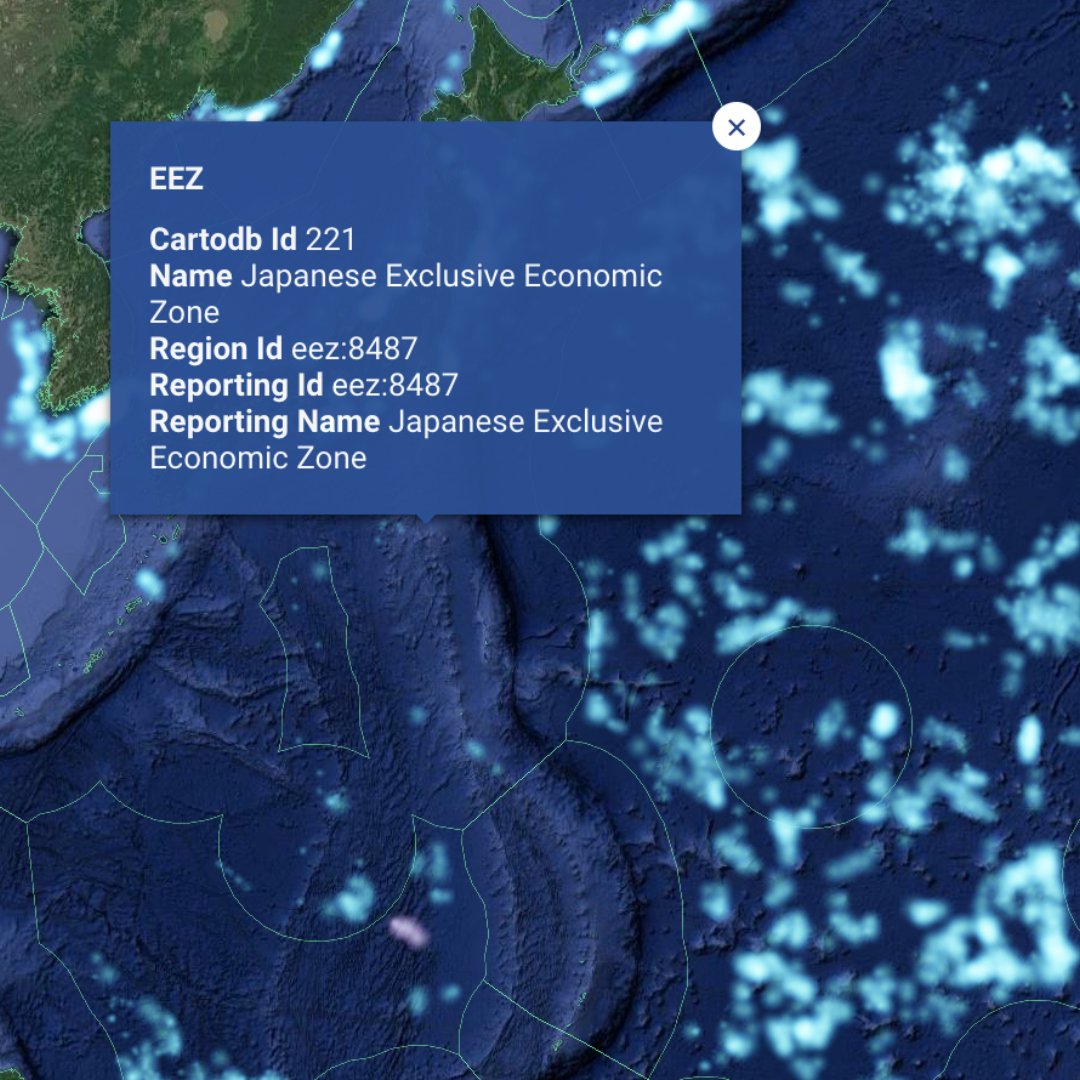
排他的経済水域(EEZ)または地域漁業管理機関(RFMO)について、観察してみようと思われるレイヤーのレポートアイコン(レイヤー名の一番近くのアイコン)をクリックします。選択するとレポートアイコンは白色に変わります。
興味をお持ちのエリア内をクリックします(EEZまたはRFMO内など)。
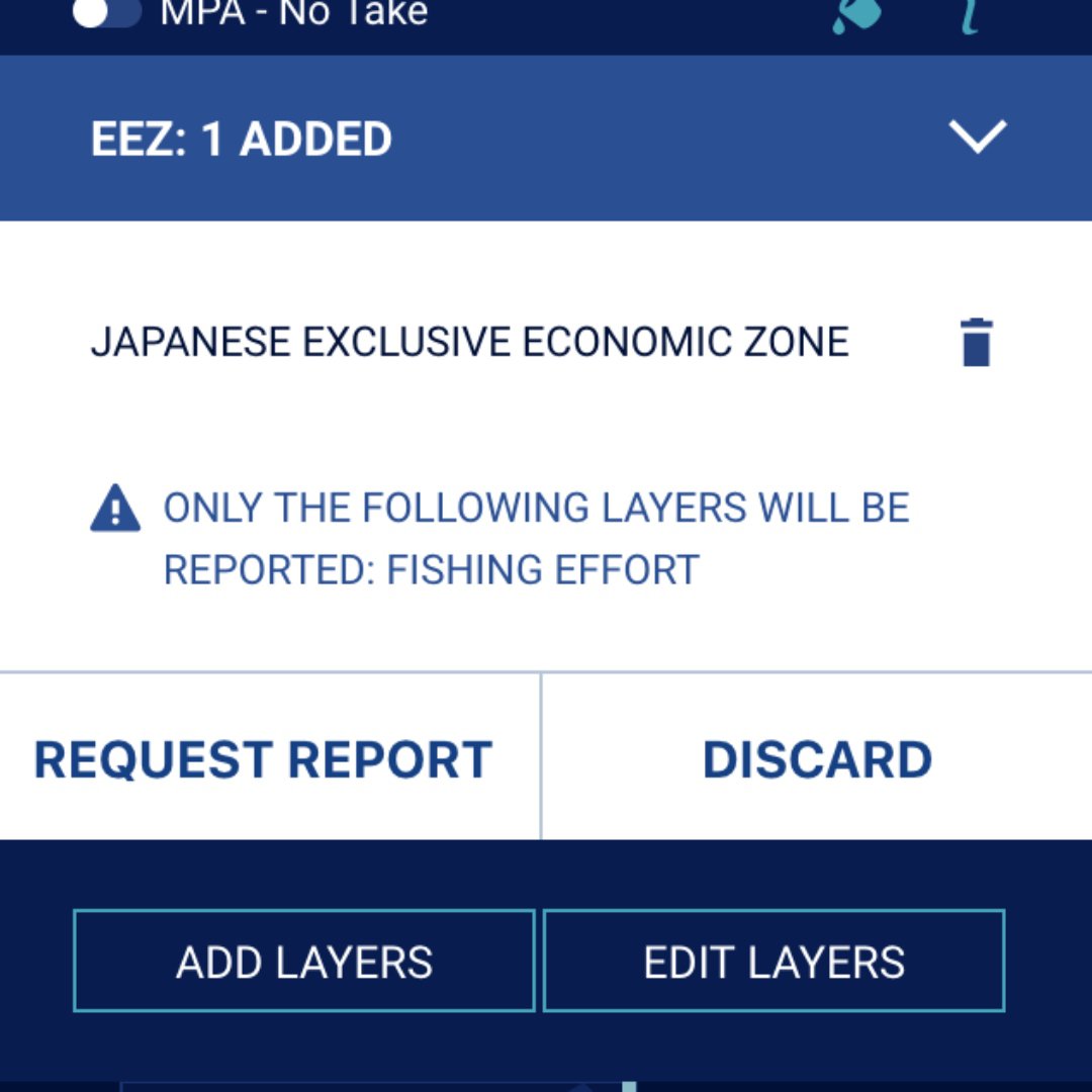
選択したエリアの名前を記したポップアップボックスが表示されます。「Add to report」をクリックします。複数の地域を選択することもできます。
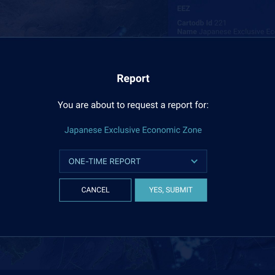
ツールボックスで「Request Report」をクリックします。
対象エリアについてレポートを受信する頻度を選択します。
レポートはメールの添付ファイルにより、数分後に配信されます。
漁獲活動にフィルターを適用する
サブ:フラグの状態または歯車の種類によって、漁獲活動にフィルターを適用する方法をご説明します。
フラグの状態によってフィルターを適用するには、まず「Layers」を、次に「Activity Layers」をクリックします。
「Fishing effort」を有効にします。
「Filters」をクリックします。
「Create filter」をクリックします。
「fishing effort」を選択します。
「Country」から「Argentina」を選択します。
「Save」をクリックします。
アルゼンチンの周りをスクロールして、アルゼンチン籍の船による漁獲活動を表示します。再生をクリックして、時間の経過にともなうアルゼンチンの人々による漁獲活動を表示します。
アルゼンチンの漁獲活動を別の国のものと比較するには、その国に対してステップ3~4を繰り返します。ペルーとチリに対してステップ3~4を繰り返します。
フラグの状態ごとに異なる色を選択します。
再生をクリックして、これら3種類のフラグの状態にある漁獲活動を表示する
おめでとうございます!

「Global Fishing Watch:漁獲活動を行う船団または船舶を監視する」を終了されました。
引き続きデジタルジャーナリズムのスキルを磨き、Google News Initiative認証に向かって努力するには、訓練センターのウェブに移動して、別のレッスンを受けてください:
For more Environmental Journalism lessons, visit:
newsinitiative.withgoogle.com/training/course/environmental-journalism