


5 minutes to complete
Video: Google Earth and mapping technologies for journalists

From identifying your local high street to a story happening on the other side of the world – discover how journalists can use Google Earth and mapping technologies.
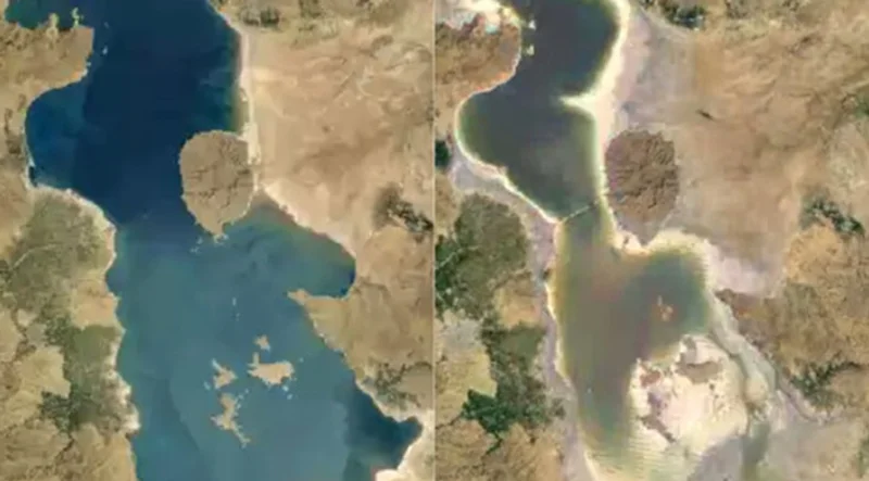
Around the world, wildfires, flooding and other extreme weather events continue to affect our health, our economies and our future together on our planet. Explore the tools to help tell the story. Use tools and resources to help you find, verify and tell engaging stories.
Congratulations! You've just finished
Video: Google Earth and mapping technologies for journalists
in progress
Recommended for you
-
![gni_business_lesson_play_6]()
Learn more about your audience with surveys
LessonUnderstand your audience, their habits, and what they value with surveys -
![GO801_GNI_GoogleEarthPro_TitleCard.jpg]()
Google Historical Imagery: Google Earth Pro, Maps and Timelapse
LessonFind out where a photo was taken and when it was uploaded. -
![gni_business_lesson_play_17]()
Keep visitors engaged with video on YouTube
LessonBuild your relationship with billions of YouTube viewers
How would you rate this lesson?
Your feedback will help us to continuously improve our lessons!